Rafah, May 30 (RHC)-- Satellite images of Rafah’s Tal as-Sultan show the area before and after the Israeli missile attack that triggered a huge blaze and killed at least 50 people.
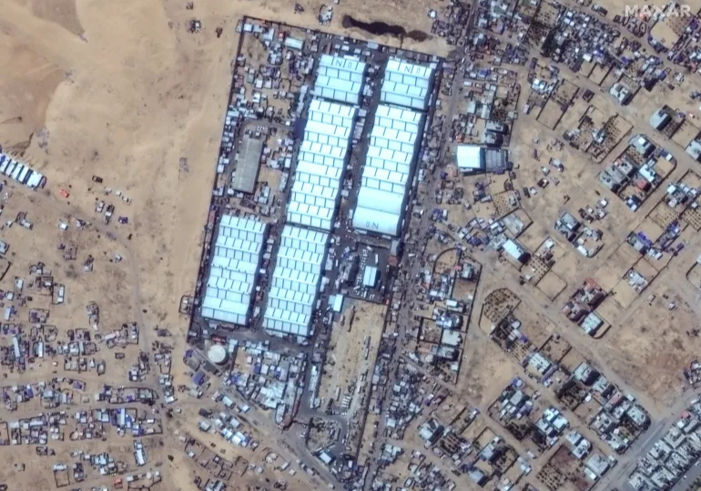
This image shows dozens of tents set up near a UN facility in Tal as-Sultan on May 26, 2024, a day before Israel launched a deadly attack on the area [Maxar Technologies/Handout via Reuters]
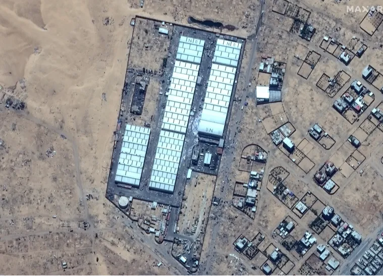
Satellite image shows the UN camp in the Tel al-Sultan area in the western district of Rafah, in the aftermath of the Rafah airstrike, May 29, 2024. Two days after the missile attack, the ground appears charred while most of the tents housing the displaced have disappeared [Maxar Technologies/Handout via Reuters]