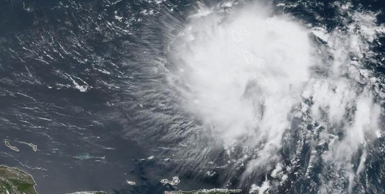
San Juan, August 27 (RHC)-- Puerto Rico and the Dominican Republic braced for Tropical Storm Dorian on Tuesday as it churned west-northwest, with officials cautioning that it could approach hurricane-strength on Wednesday after blowing over Barbados.
"Slow strengthening is forecast during the next 48 hours, and Dorian is forecast to be near hurricane strength when it moves close to Puerto Rico and eastern Hispaniola," the U.S. National Hurricane Center (NHC) said in a report.
The storm's centre is expected to pass near or south of Puerto Rico on Wednesday, move near or over eastern Hispaniola, the island that includes the Dominican Republic and Haiti, on Wednesday night and move north of Hispaniola on Thursday.
"Tropical storm conditions are expected and hurricane conditions are possible in Puerto Rico on Wednesday and in portions of the Dominican Republic Wednesday night and Thursday," said the NHC.
Puerto Rico Governor Wanda Vazquez Garced declared a state of emergency for the U.S. territorial colony late on Monday in anticipation of the storm, the government said on Twitter.
The storm is expected to dump between eight to 150mm (three to six inches) of rain in the Windward Islands, with isolated amounts of 250mm (10 inches). Dorian already caused power outages and downed trees in Barbados and St Lucia, and a still-uncertain long-term track showed the storm near Florida over the weekend.
"The threat of winds and heavy rains later this week, into this weekend, in the Turks and Caicos, the Bahamas and Florida is increasing. Residents in these areas should monitor progress of Dorian and ensure that they have their hurricane plan in place," said the National Hurricane Center.
A hurricane watch is in effect for Puerto Rico and the Dominican Republic.
By late Tuesday morning, the storm was located about 95km (60 miles) west-northwest of St Lucia, blowing maximum sustained winds of 50 miles per hour (85kph).


