Cuba continues to monitor the path of Hurricane Beryl
Havana, Jul 2 (RHC) The Forecasting Centre of the Cuban Meteorological Institute (INSMET) announced on Tuesday that it will closely monitor the evolution of Hurricane Beryl as it passes over the seas south of Cuba on Wednesday and Thursday.
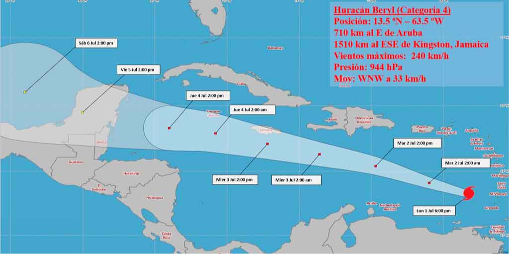
MSc Alis Varela de la Rosa told Granma newspaper that the first hurricane of the 2024 season, after hitting the southern islands of the Lesser Antilles, is expected to move west-northwest on Tuesday to cross the southern seas, a little away from the Dominican Republic.
At 18:00 local time on Monday, Beryl was an intense Category 4 hurricane on the Saffir-Simpson Scale, with maximum sustained winds of 240 km/h, with higher gusts, and a minimum central pressure of 944 hectopascals.
Weather model forecasts indicate that such a hurricane will hit the Yucatan Peninsula on Friday.
Hurricane Beryl has become the most intense cyclone in the tropical Atlantic basin for June.
Professor Luis Enrique Ramos, coordinator of the Historical Commission of the Cuban Meteorological Society, pointed out that its rapid intensification is striking. (Source: Prensa Latina)