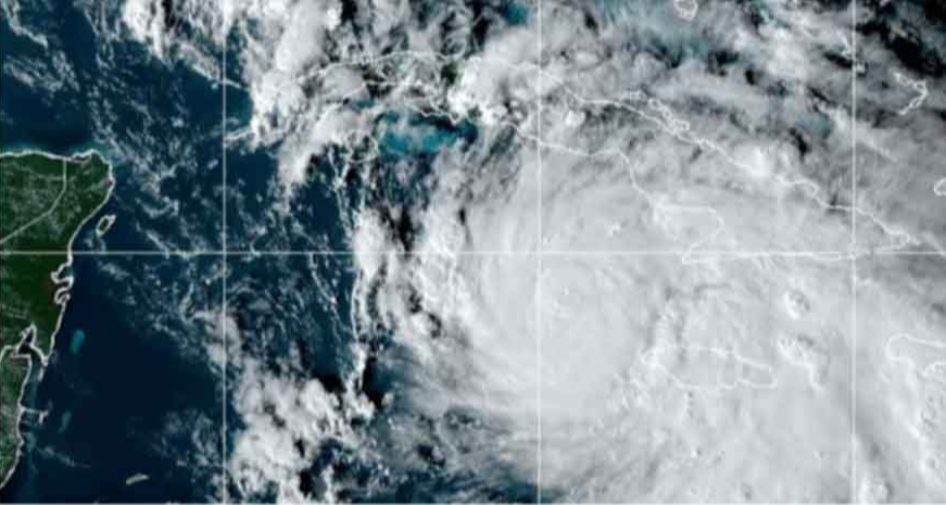
Rafael will cross over western Cuba this afternoon and then move southeast of the Gulf of Mexico in the evening
Havana, Nov 6 (RHC) The National Hurricane Center (NHC) has predicted that Hurricane Rafael will be close to the intensity of a powerful cyclone when it touches Cuba today, so the winds associated with this type of storm will be experienced across the western part of the island.
According to the NHC, at 4 a.m. local time, the center of the storm was located near latitude 20.6 North and longitude 81.3 West.
Rafael is moving northwestward at a speed of approximately 22 kilometers per hour, and the NHC expects it to continue moving in a generally northwest direction for the next few hours, followed by a gradual turn to the west-northwest over the Gulf of Mexico.
The NHC predicts that Rafael will cross over western Cuba this afternoon and then move southeast of the Gulf of Mexico in the evening.
The maximum sustained winds have increased to around 150 km/h, with stronger gusts, and the storm is expected to continue strengthening. However, it may weaken briefly over Cuba before emerging as a hurricane in the southeastern Gulf of Mexico.
The NHC stated that hurricane-force winds extend outward 30 kilometers from the center, and tropical storm-force winds extend outward up to 165 kilometers. The estimated minimum central pressure based on observations is 970 millibars.
Rafael is the eleventh hurricane to reach category one on the Saffir-Simpson scale this hurricane season.
The rainfall associated with the hurricane will gradually spread during the night and early morning to the west of Cuba, and it may be heavy and intense in some areas, with accumulated amounts ranging from 100 to 200 millimeters in 24 hours. (Source: Prensa Latina)

