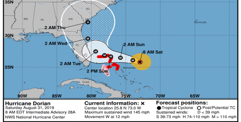
Miami, August 31 (RHC)-- Hurricane Dorian strengthened and shifted slightly early Saturday, setting it on course to potentially miss a direct hit with Florida and make landfall in the Carolinas.
"There's been a notable change overnight to the forecast of Dorian after Tuesday," the National Hurricane Center said on Twitter Saturday morning, stressing that this shift does not rule out the possibility of the storm making landfall on the Florida coast.
Dorian became a potentially devastating Category 4 storm Friday evening as it continued to churn in the Atlantic Ocean on its course to the southeastern United States early next week.
"It’s important to stress that this doesn’t paint Florida as out of the woods yet," said Kathryn Prociv, a meteorologist for NBC News. "Florida is still very much in the red zone," she added.
Dorian will continue westward through the weekend but is then forecast to turn northward as it approaches the east coast of Florida early next week, the center said. It will bring "risks of life-threatening storm surge, devastating hurricane-force winds, heavy rainfall and flooding along its path."
As of the NHC's 8 a.m. ET advisory Saturday, the storm was located 280 miles east of the northwestern Bahamas and 445 miles east of West Palm Beach.


