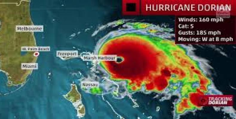
Miami, September 1 (RHC)-- Hurricane Dorian crashed into the Bahamas on Sunday as the second strongest Atlantic storm on record and inched closer to the United States, with parts of Florida evacuating and Georgia and the Carolinas bracing for wind and flooding.
The U.S. National Hurricane Center (NHC) in Miami said Dorian made landfall on Elbow Cay in the Abaco Islands as a Category 5 storm with maximum sustained winds of 185 miles per hour (295 kph) and gusts of more than 220 mph (354 kph). It made a second landfall on Great Abaco Island near Marsh Harbor and was now 70 miles (113 km) from the Florida coast.
Millions of people from Florida to North Carolina were bracing to see whether Dorian avoids a U.S. landfall and veers north into the Atlantic Ocean. Even a glancing blow from one of the strongest storms ever to menace Florida could bring torrential rains and damaging winds, and “a Florida landfall is still a distinct possibility,” the Miami-based NHC warned.
Residents on Abaco posted video on social media showing floodwaters halfway up the sides of single-family homes with parts of the roofs torn off. Car alarms blared across the island, which was littered with twisted metal and splintered wood. Forecasters predicted up to 30 inches (76 cm) of rain and 23-foot (7-metre) storm surges from the Category 5 storm on the five-step Saffir-Simpson Wind Scale.
The pummeling was expected to last for hours as the hurricane may slow to just 1 mph (1.6 kph), “prolonging its catastrophic effects,” the NHC said.
Bahamian Prime Minister Hubert Minnis said in a nationally televised news conference that a “deadly storm and a monster storm” was battering the region. The islands’ homes are built to withstand winds of at least 150 mph (241 kph), but the 20-foot (6-metre) storm surge is higher than the average roof.


