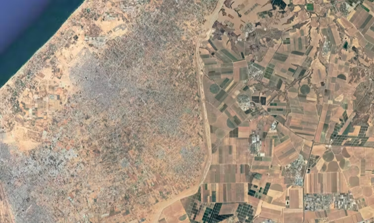
United Nations, September 25 (RHC)-- According to UN satellite imagery dating from August 27, 68 percent of Gaza’s farmland has been damaged due to Israel’s war, the equivalent of 102 square kilometres (39 square miles).
The imagery found that 78 percent of the damage is in northern Gaza’s farmland and 57 percent of it is in Rafah, in Gaza’s south. In addition, 68 percent of Gaza’s road network has been damaged and about 1,190 kilometres (739 miles) of roads have been destroyed, according to a preliminary analysis by the United Nations Satellite Centre (UNOSAT) which looked at data up to August 18.
“It is unimaginable, the level of suffering in Gaza, the level of deaths and destruction have no parallel in everything I’ve witnessed since [becoming] secretary-general,” UN chief Antonio Guterres said earlier this month.